Category:Maps by Samuel Augustus Mitchell
Jump to navigation
Jump to search
Subcategories
This category has the following 4 subcategories, out of 4 total.
M
- Mitchell's school atlas (35 F)
Media in category "Maps by Samuel Augustus Mitchell"
The following 200 files are in this category, out of 333 total.
(previous page) (next page)-
Young & Mitchell A New Map of Texas 1836 UTA.jpg 4,000 × 2,769; 19.51 MB
-
1836 Tanner Map of Palestine - Israel - Holy Land - Geographicus - Palestine-tanner-1836.jpg 3,256 × 4,000; 2.19 MB
-
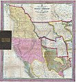
Mitchell A New Map of Texas, Oregon, and California 1846 UTA.jpg 5,412 × 5,814; 25.88 MB
-
1846 Burroughs - Mitchell Map of Kentucky - Geographicus - KT-m-1846.jpg 2,835 × 2,340; 1.84 MB
-
1846 Burroughs - Mitchell Map of Mississippi - Geographicus - MS-m-1846.jpg 2,340 × 2,854; 1.73 MB
-
1846 Burroughs - Mitchell Map of Ohio - Geographicus - Ohio-m-1846.jpg 2,854 × 3,500; 2.81 MB
-
1846 map of Turkey in Europe.tif 8,128 × 10,314; 171.69 MB
-
1846 Mitchell - Burroughs Map of South Carolina - Geographicus - SC-m-1846.jpg 3,500 × 2,831; 2.69 MB
-
1846 Mitchell - Tanner Map of New Jersey - Geographicus - NewJersey-mitchell-1848.jpg 3,878 × 4,653; 3.32 MB
-
1846 Mitchell's Map of Texas Oregon and California - Geographicus - TXORCA-mitchell-1846.jpg 5,000 × 5,420; 5.64 MB
-
1846 Street Map or Plan of Philadelphia, Pennsylvania - Geographicus - Phili-m-1846.jpg 2,415 × 3,000; 2.06 MB
-
Mitchell & Stealey Map of Mexico 1847 UTA (Battle Field of Monterey).jpg 796 × 737; 689 KB
-
Mitchell & Stealey Map of Mexico 1847 UTA (Map of Mexico).jpg 2,782 × 2,057; 6.62 MB
-
Mitchell & Stealey Map of Mexico 1847 UTA.jpg 2,983 × 4,136; 11.91 MB
-
Mitchell Map of Mexico Including Yucatan & Upper California 1847 UTA.jpg 2,688 × 3,668; 1.76 MB
-
Tanner Africa 1847 UTA.jpg 4,689 × 3,850; 7.11 MB
-
1848 Mitchell Map of New York City - Geographicus - NewYorkCity-mitchell-1848.jpg 2,826 × 3,500; 3.56 MB
-
1849 Cowperthwait - Mitchell Map of Mississippi - Geographicus - MS-m-49.jpg 2,450 × 3,000; 2.14 MB
-
1850 Cabul detail map Persia, Arabia &c by Mitchell.png 1,261 × 686; 2.16 MB
-
1850 Candahar detail map Persia, Arabia &c by Mitchell.png 1,261 × 686; 2.16 MB
-
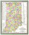
1850 Cowperthwait - Mitchell Map of Indiana - Geographicus - IN-m-50.jpg 2,503 × 3,000; 2.18 MB
-
1850 Cowperthwait - Mitchell Map of New Jersey - Geographicus - NJ-m-50.jpg 2,475 × 3,000; 2.41 MB
-
1850 Cowperthwait - Mitchell Map of Pennsylvania - Geographicus - PA-m-50.jpg 3,000 × 2,417; 2.34 MB
-
1850 Cowperthwait Map of Cuba and West Indies - Geographicus - WestIndies-m-1850.jpg 3,500 × 2,820; 2.26 MB
-
1850 Cowperthwait Map of Illinois - Geographicus - IL-m-50.jpg 3,296 × 4,000; 3.39 MB
-
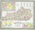
1850 Cowperthwait Map of Kentucky - Geographicus - KT-m-50.jpg 3,000 × 2,558; 2.24 MB
-
1850 Kurachee detail map Persia, Arabia &c by Mitchell.png 1,258 × 687; 2.21 MB
-
1850 Mitchell - Cowperthwait Map of Denmark - Geographicus - Denmark-cowperthwait-1850.jpg 2,451 × 3,000; 2.23 MB
-
1850 Mitchell - Mitchell Map of Turkey in Asia - Geographicus - TurkeyAsia-m-50.jpg 4,000 × 3,278; 3.18 MB
-
1850 Mitchell and Cowperthwait Map of Ireland - Geographicus - Ireland-m-1850.jpg 2,416 × 3,000; 2.02 MB
-
1850 Mitchell Map of Arabia, Persia, Afghanistan - Geographicus - Arabia-mitchell-1850.jpg 3,500 × 2,865; 2.77 MB
-
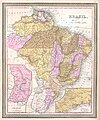
1850 Mitchell Map of Brazil, Paraguay and Guiana - Geographicus - Brazil-m-1849.jpg 3,342 × 4,000; 2.54 MB
-
1850 Mitchell Map of Eastern Canada including Quebec - Geographicus - CanadaQuebec-c-50.jpg 2,500 × 2,021; 1.63 MB
-
1850 Mitchell Map of Europe - Geographicus - Europe-mitchell-1850.jpg 3,500 × 2,788; 3.12 MB
-
1850 Mitchell Map of Greece - Geographicus - Greece-m-50.jpg 3,000 × 2,444; 2.4 MB
-
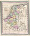
1850 Mitchell Map of Holland and Belgium - Geographicus - HollandBelgium-mitchell-1850.jpg 2,496 × 3,000; 2.21 MB
-
1850 Mitchell Map of Ireland - Geographicus - Ireland2-mitchell-1850.jpg 3,059 × 3,848; 3.01 MB
-
1850 Mitchell Map of Maine - Geographicus - Maine-mitchell-1850.jpg 3,166 × 4,000; 2.68 MB
-
1850 Mitchell Map of Mexico ^ Texas - Geographicus - MexicoTexas-m-50.jpg 3,117 × 2,533; 2.37 MB
-
1850 Mitchell Map of New York City - Geographicus - NewYorkCity-mitchell-1850.jpg 2,500 × 3,096; 2.78 MB
-
1850 Mitchell Map of Ohio - Geographicus - Ohio-m-50.jpg 3,313 × 4,000; 3.68 MB
-
1850 Mitchell Map of Persia, Arabia and Afghanistan - Geographicus - Arabia-m-50.jpg 4,000 × 3,284; 3.01 MB
-
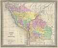
1850 Mitchell Map of Peru and Bolivia - Geographicus - PeruBolivia-mitchell-1850.jpg 3,500 × 2,904; 3.55 MB
-
1850 Mitchell Map of Prussia Germany - Geographicus - Prussia-m-50.jpg 2,000 × 1,620; 955 KB
-
1850 Mitchell Map of South America - Geographicus - SouthAmerica-mitchell-1850.jpg 3,000 × 3,715; 2.41 MB
-
1850 Mitchell Map of Spain and Portugal - Geographicus - Spain-c-53.jpg 3,000 × 2,411; 2.33 MB
-
1850 Mitchell Map of Spain and Portugal - Geographicus - SpainPortugal-mitchell-1850.jpg 3,000 × 2,423; 1.68 MB
-
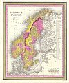
1850 Mitchell Map of Sweden and Norway - Geographicus - SwedenNorway-m-50.jpg 2,495 × 3,000; 2.12 MB
-
1850 Mitchell Map of Washington D.C. ^ Georgetown - Geographicus - WashingtonDC-m-1850.jpg 4,000 × 3,234; 3.03 MB
-
1853 Mitchell Map of Arkansas - Geographicus - AR-mitchell-1850.jpg 2,852 × 3,500; 3.33 MB
-
1853 Mitchell Map of Asia - Geographicus - Asia-mitchell-1850.jpg 3,500 × 2,837; 3.95 MB
-
1853 Mitchell Map of Austria - Geographicus - Austrai-mitchell-1853.jpg 3,000 × 2,385; 2.43 MB
-
1853 Mitchell Map of China - Geographicus - China-mitchell-1850.jpg 3,500 × 2,797; 3.91 MB
-
1853 Mitchell Map of France - Geographicus - France-mitchell-1853.jpg 3,000 × 3,723; 3.98 MB
-
1853 Mitchell Map of Germany - Geographicus - Germany-mitchell-1850.jpg 2,389 × 3,000; 2.54 MB
-
1853 Mitchell Map of Greece - Geographicus - Greece-mitchell-1850.jpg 3,000 × 2,431; 2.27 MB
-
1853 Mitchell Map of India - Geographicus - Hindoostan-mitchell-1850.jpg 2,865 × 3,500; 4.02 MB
-
1853 Mitchell Map of Louisiana - Geographicus - LA-mitchell-1850.jpg 3,664 × 3,000; 3.96 MB
-
1853 Mitchell Map of Michigan - Geographicus - Michigan-mitchell-1850.jpg 2,839 × 3,500; 3.45 MB
-
1853 Mitchell Map of Mississippi - Geographicus - MS-mitchell-1850.jpg 2,889 × 3,500; 3.57 MB
-
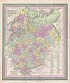
1853 Mitchell Map of Russia - Geographicus - Russia-mitchell-1853.jpg 2,521 × 3,000; 2.45 MB
-
1853 Mitchell Map of Switzerland - Geographicus - Switzerland-mitchell-1853.jpg 3,000 × 2,454; 2.38 MB
-
1860 Map of Persia, Turkey in Asia, Afghanistan, Beloochistan.jpg 9,825 × 8,001; 10.25 MB
-
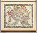
1860 Map Of The Austrian Empire, Italian States, Turkey In Europe and Greece.jpg 5,057 × 4,409; 4.4 MB
-
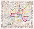
1860 Mitchell Map of Baltimore - Geographicus - Baltimore-m-60.jpg 3,445 × 2,906; 2.7 MB
-
1860 Mitchell Map of Europe - Geographicus - Europe-m-63.jpg 3,000 × 2,430; 2.41 MB
-
1860 Mitchell's Map of California - Geographicus - CA-m-1860.jpg 3,302 × 4,131; 3.69 MB
-
1860 Mitchell's Map of Ohio and Indiana - Geographicus - INOH-m-63.jpg 2,000 × 1,610; 1.11 MB
-
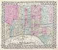
1860 Mitchell's Street Map of Philadelphia - Geographicus - Phili-m-60.jpg 3,500 × 2,966; 3 MB
-
1860 Plan of Boston by S. Augustus Mitchell Jr.jpg 6,038 × 7,606; 46.34 MB
-
1860 TremontRow map Boston by S Augustus Mitchell BPL 10040.png 676 × 521; 679 KB
-
1861 Mitchell's Map of Illinois w- Chicago Inset - Geographicus - IL-m-60.jpg 2,774 × 3,500; 2.72 MB
-
1862 Mitchell Map of Kentucky and Tennessee - Geographicus - KTTN-m-62.jpg 3,000 × 2,393; 2.42 MB
-
1862 Mitchell's Map of Vermont and New Hampshire - Geographicus - VTNH-m-63.jpg 2,492 × 3,000; 2.29 MB
-
1864 Mitchell Map of Africa - Geographicus - Africa-mitchell-1864.jpg 4,000 × 3,214; 2.82 MB
-
1864 Mitchell Map of Asia - Geographicus - Asia-mitchell-1864.jpg 4,000 × 3,199; 3.02 MB
-
1864 Mitchell Map of Australia and Polynesia - Geographicus - Oceanica-mitchell-1864.jpg 4,000 × 3,186; 2.9 MB
-
1864 Mitchell Map of Baltimore, Maryland - Geographicus - Baltimore-mitchell-1864.jpg 3,458 × 2,964; 2.14 MB
-
1864 Mitchell Map of Boston, Massachusetts - Geographicus - Boston-mitchell-1864.jpg 2,964 × 3,548; 2.28 MB
-
1864 Mitchell Map of Cincinnati. Ohio - Geographicus - Cincinnati-mitchell-1864.jpg 3,596 × 3,353; 2.36 MB
-
1864 Mitchell Map of Colorado, Kansas ^ Nebraska - Geographicus - COKANE-mitchell-1864.jpg 4,000 × 3,292; 2.32 MB
-
1864 Mitchell Map of England and Wales - Geographicus - England-mitchell-1864.jpg 3,208 × 4,000; 2.92 MB
-
1864 Mitchell Map of Europe - Geographicus - Europe-mitchell-1864.jpg 4,000 × 3,254; 2.68 MB
-
1864 Mitchell Map of Georgia and Alabama - Geographicus - GAAL-mitchell-1860.jpg 3,500 × 2,859; 3.97 MB
-
1864 Mitchell Map of Iowa and Missouri - Geographicus - IAMO-mitchell-1864.jpg 3,261 × 4,000; 2.6 MB
-
1864 Mitchell Map of Ireland and Scotland - Geographicus - IrelandScotland-mitchell-1864.jpg 4,000 × 3,216; 3.03 MB
-
1864 Mitchell Map of Maine - Geographicus - ME-mitchell-1864.jpg 3,183 × 4,000; 4.67 MB
-
1864 Mitchell Map of Michigan and Wisconsin - Geographicus - MIWI-mitchell-1864.jpg 4,000 × 3,291; 2.91 MB
-
1864 Mitchell Map of Minnesota - Geographicus - MN-mitchell-1864.jpg 3,265 × 4,000; 2.55 MB
-
1864 Mitchell Map of New Orleans, Louisiana - Geographicus - NewOrleans-m-1864.jpg 3,529 × 2,986; 2.09 MB
-
1864 Mitchell Map of New York City, New York - Geographicus - NewYorkCity-mitchell-1864.jpg 3,000 × 3,695; 2.75 MB
-
1864 Mitchell Map of North America - Geographicus - NorthAmerica-mitchell-1864.jpg 3,204 × 4,000; 2.85 MB
-
1864 Mitchell Map of Ohio and Indiana - Geographicus - OHIN-mitchell-1864.jpg 4,000 × 3,213; 3 MB
-
1864 Mitchell Map of Ontario, Canada - Geographicus - CanadaWest-mitchell-1864.jpg 4,000 × 3,204; 2.64 MB
-
1864 Mitchell Map of Palestine, Israel or the Holy Land - Jerusalem inset map.jpg 1,136 × 1,589; 381 KB
-
1864 Mitchell Map of Prussia and Germany - Geographicus - Prussia-mitchell-1864.jpg 4,000 × 3,199; 2.83 MB
-
1864 Mitchell Map of Quebec, Canada - Geographicus - CanadaEast-mitchell-1864.jpg 4,000 × 3,221; 2.41 MB
-
1864 Mitchell Map of South America - Geographicus - SouthAmerica-mitchell-1864.jpg 3,331 × 4,216; 3.02 MB
-
1864 Mitchell Map of Texas - Geographicus - TX-mitchell-1864.jpg 4,000 × 3,226; 2.44 MB
-
1864 Mitchell Map of the United States - Geographicus - UnitedStates-mitchell-1864.jpg 4,000 × 2,547; 2.26 MB
-
1864 Mitchell Map of Washington D.C. - Geographicus - WashingtonDC-mitchell-1864.jpg 4,000 × 3,287; 2.36 MB
-
1864 Mitchell Map of Washington, Oregon and Idaho - Geographicus - WAORID-mitchell-1864.jpg 4,000 × 3,185; 2.47 MB
-
1866 Boulder detail Map of Kansas, Nebraska and Colorado by Mitchell.png 1,264 × 665; 1.92 MB
-
1866 Mitchell Map of California - Geographicus - California-mitchell-1866.jpg 2,766 × 3,500; 3.4 MB
-
1866 Mitchell Map of Texas - Geographicus - Texas-mitchell-1866.jpg 3,500 × 2,838; 3.15 MB
-
1866 Mitchell Map of the United States - Geographicus - UnitedStates-mitchell-1866.jpg 4,000 × 2,537; 3.58 MB
-
1866 Mitchell Map of Utah and Nevada - Geographicus - UtahNevada-mitchell-1866.jpg 3,500 × 2,923; 2.84 MB
-
1866 Mitchell Map of Washington D.C. - Geographicus - WashingtonDC-mitchell-1866.jpg 3,500 × 2,880; 2.98 MB
-
1867 Mitchell Map of Baltimore, Maryland - Geographicus - Baltimore-mitchell-1867.jpg 3,500 × 2,966; 3.41 MB
-
1867 Mitchell Map of New York City, New York - Geographicus - NewYorkCity-mitchell-1870.jpg 5,000 × 3,291; 5.13 MB
-
1867 Mitchell Map of New York State - Geographicus - NewYork-mitchell-1867.jpg 5,000 × 3,355; 6.15 MB
-
1867 Mitchell Map of Pennsylvania - Geographicus - PA-mitchell-1867.jpg 4,369 × 3,601; 2.96 MB
-
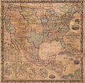
1867 Mitchell Map of the United States - Geographicus - UnitedStates-mitchell-1867.jpg 5,000 × 3,174; 3.42 MB
-
1870 Chicago map by Mitchell.jpg 2,405 × 3,000; 1.93 MB
-
1872 Mitchell Map of California w- San Francisco Inset - Geographicus - CA-mitchell-1872.jpg 3,402 × 5,000; 5.53 MB
-
1872 Mitchell Map of Cuba and the Bahamas - Geographicus - Cuba-mitchell-1872.jpg 4,437 × 3,503; 6.12 MB
-
1872 Mitchell Map of Prussia, Germany - Geographicus - Prussia-mitchell-1872.jpg 3,500 × 2,796; 3.51 MB
-
1872 Mitchell Map of the City of Detroit, Michigan - Geographicus - Detroit-m-72.jpg 3,000 × 2,235; 1.68 MB
-
1872 Mitchell Map of Utah and Nevada - Geographicus - UTNV-mitchell-1872.jpg 4,000 × 3,231; 3.34 MB
-
1874 Mitchell Map of Chicago.jpg 2,500 × 3,042; 3.53 MB
-
1874 Mitchell Map of Florida w- Mobile, Alabama inset - Geographicus - FL-m-1874.jpg 3,000 × 2,386; 2.34 MB
-
1874 Mitchell Map of Iowa and Missouri - Geographicus - IOMS-m-1874.jpg 2,493 × 3,000; 2.54 MB
-
1874 Mitchell Map of North America ^ the United States - Geographicus - AmerNorth-m-1874.jpg 2,390 × 3,000; 2.52 MB
-
1874 Mitchell Map of Ontario, Canada - Geographicus - Ontario-m-1874.jpg 3,000 × 2,384; 2.27 MB
-
1874 Mitchell Map of Ontario, Canada.jpg 2,935 × 2,310; 1.57 MB
-
1874 Mitchell Map of Pennsylvania - Geographicus - PA-m-1874.jpg 3,000 × 2,440; 2.58 MB
-
1874 Mitchell Map of Quebec, Canada - Geographicus - Quebec-m-1874.jpg 3,000 × 2,391; 2.24 MB
-
1874 Mitchell Map of Russia - Geographicus - Russia-m-1874.jpg 3,000 × 2,360; 2.5 MB
-
1874 Mitchell Map of the Maritime Provinces of Canada.jpg 2,327 × 2,957; 2.1 MB
-
1874 Mitchell Map of Vermont and New Hampshire - Geographicus - VTNH-m-1874.jpg 2,454 × 3,000; 2.32 MB
-
1877 Mitchell Map of Vermont and New Hampshire - Geographicus - VTNH-mitchell-1877.jpg 2,701 × 4,000; 3.84 MB
-
1877 Mitchell's map of Chicago.jpg 3,453 × 4,266; 8.01 MB


_-_geographicus_-_usawall-mitchell-1844.jpg)



.jpg)
.jpg)
.jpg)

.jpg)


_-_geographicus_-_turkeyasia-m-1849.jpg)






.jpg)











%2c_uruguay_and_chili_-_geographicus_-_laplata-mitchell-1850.jpg)


_-_geographicus_-_italynorth-mitchell-1850.jpg)


_-_geographicus_-_italysouth-mitchell-1850.jpg)

_-_geographicus_-_turkeyasia-mitchell-1850.jpg)
_-_geographicus_-_turkeyeurope-mitchell-1850.jpg)



_-_geographicus_-_miwi-mitchell-1860.jpg)
_-_geographicus_-_nyc-mitchell-1860.jpg)
_and_north_carolina_-_geographicus_-_vanc-mitchell-1860.jpg)











_-_geographicus_-_persia-mitchell-1864.jpg)
%2c_argentina%2c_columbia_and_venezuela_-_geographicus_-_southamericanorth-mitchell-1864.jpg)







_-_geographicus_-_persiaafghanistan-mitchell-1866.jpg)







_-_geographicus_-_centralafrica-dispatch-1868.jpg)


