File:1836 Tanner Map of Palestine - Israel - Holy Land - Geographicus - Palestine-tanner-1836.jpg
Jump to navigation
Jump to search

Size of this preview: 488 × 600 pixels. Other resolutions: 195 × 240 pixels | 391 × 480 pixels | 625 × 768 pixels | 833 × 1,024 pixels | 1,667 × 2,048 pixels | 3,256 × 4,000 pixels.
Original file (3,256 × 4,000 pixels, file size: 2.19 MB, MIME type: image/jpeg)
Captions
Captions
Add a one-line explanation of what this file represents
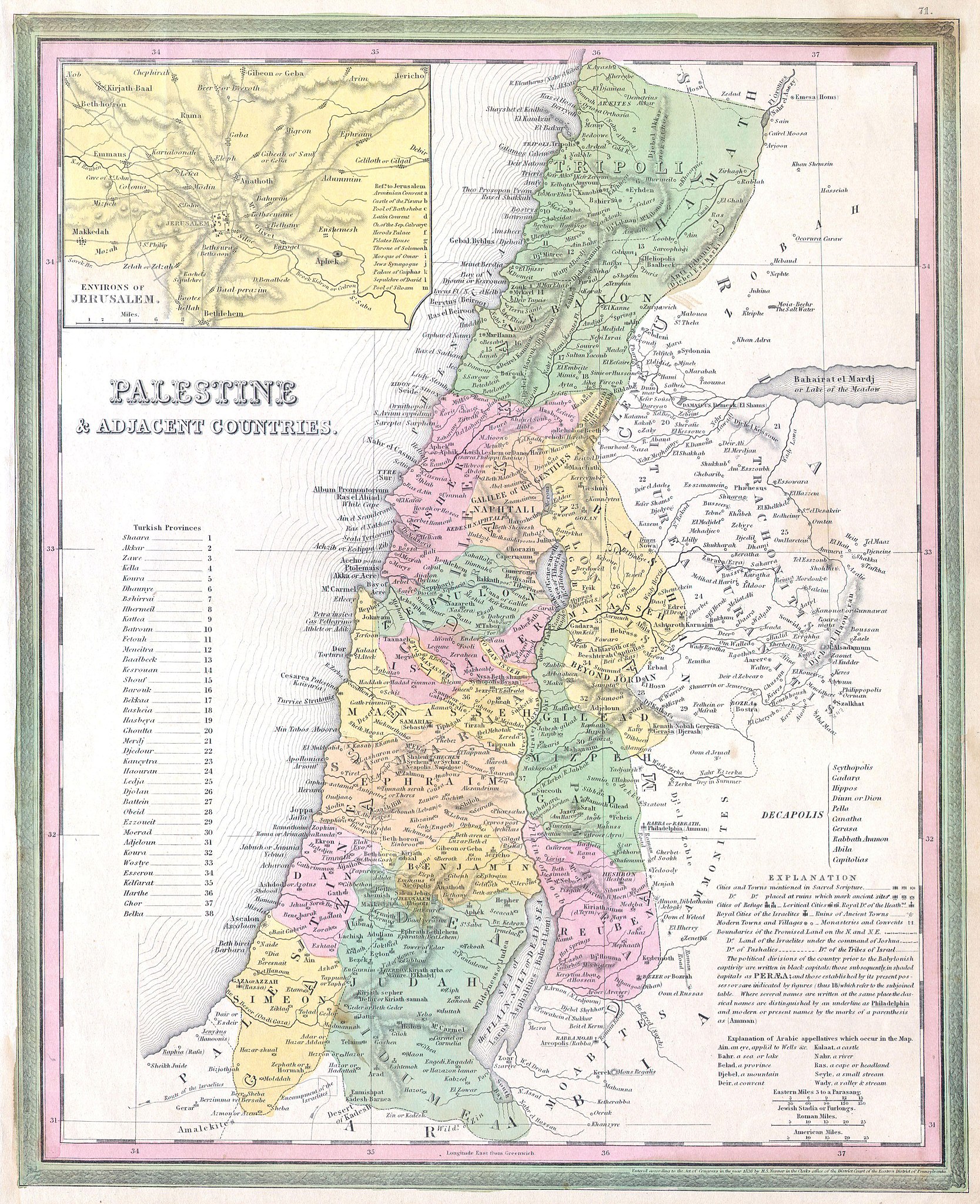
| Samuel Augustus Mitchell: Palestine & Adjacent Countries.
( |
||||||||||||||||||||
|---|---|---|---|---|---|---|---|---|---|---|---|---|---|---|---|---|---|---|---|---|
| Artist |
|
|||||||||||||||||||
| Title |
Palestine & Adjacent Countries. |
|||||||||||||||||||
| Description |
English: A fine and rare 1836 S. A. Mitchell map depicting Palestine, Israel or the Holy Land. Includes From Gaza North as far as modern day Lebanon. The regions claimed by the various tribes of Israel are noted. In the upper right there is an inset map of the Environs of Jerusalem. Specifically notes cities and towns mentioned in the Bible as well as marks Cities of Refuge, Levitical Cities, and Royal Cities of the Israelites. Ruins are also noted. Dated and copyrighted: “Entered according to the Act o Congress in the year of 1836 by H. S. Tanner in the Clerk’s office of the District Court of The Eastern District of Pennsylvania. |
|||||||||||||||||||
| Date | 1836 | |||||||||||||||||||
| Dimensions | height: 12 in (30.4 cm); width: 15.5 in (39.3 cm) | |||||||||||||||||||
| Accession number |
Geographicus link: Palestine-tanner-1836 |
|||||||||||||||||||
| Source/Photographer |
|
|||||||||||||||||||
| Permission (Reusing this file) |
|
|||||||||||||||||||
File history
Click on a date/time to view the file as it appeared at that time.
| Date/Time | Thumbnail | Dimensions | User | Comment | |
|---|---|---|---|---|---|
| current | 02:49, 25 March 2011 | | 3,256 × 4,000 (2.19 MB) | BotMultichillT (talk | contribs) | {{subst:User:Multichill/Geographicus |link=http://www.geographicus.com/P/AntiqueMap/Palestine-tanner-1836 |product_name=1836 Tanner Map of Palestine - Israel - Holy Land |map_title=Palestine & Adjacent Countries. |description=A fine and rare 1836 S. A. |
You cannot overwrite this file.
File usage on Commons
The following 2 pages use this file:
.jpg)