File:1850s Map of the World of the Biblical Noah - Geographicus - PosterityOfNoah-bochart-1850.jpg
Original file (3,500 × 2,693 pixels, file size: 2.35 MB, MIME type: image/jpeg)
Captions
Captions
Summary[edit]
| Part of Eastern Continent Shewing The Primitive Settlements and Subsequent Progress of the Posterity of Noah | ||||||
|---|---|---|---|---|---|---|
| Artist | ||||||
| Title |
Part of Eastern Continent Shewing The Primitive Settlements and Subsequent Progress of the Posterity of Noah |
|||||
| Description |
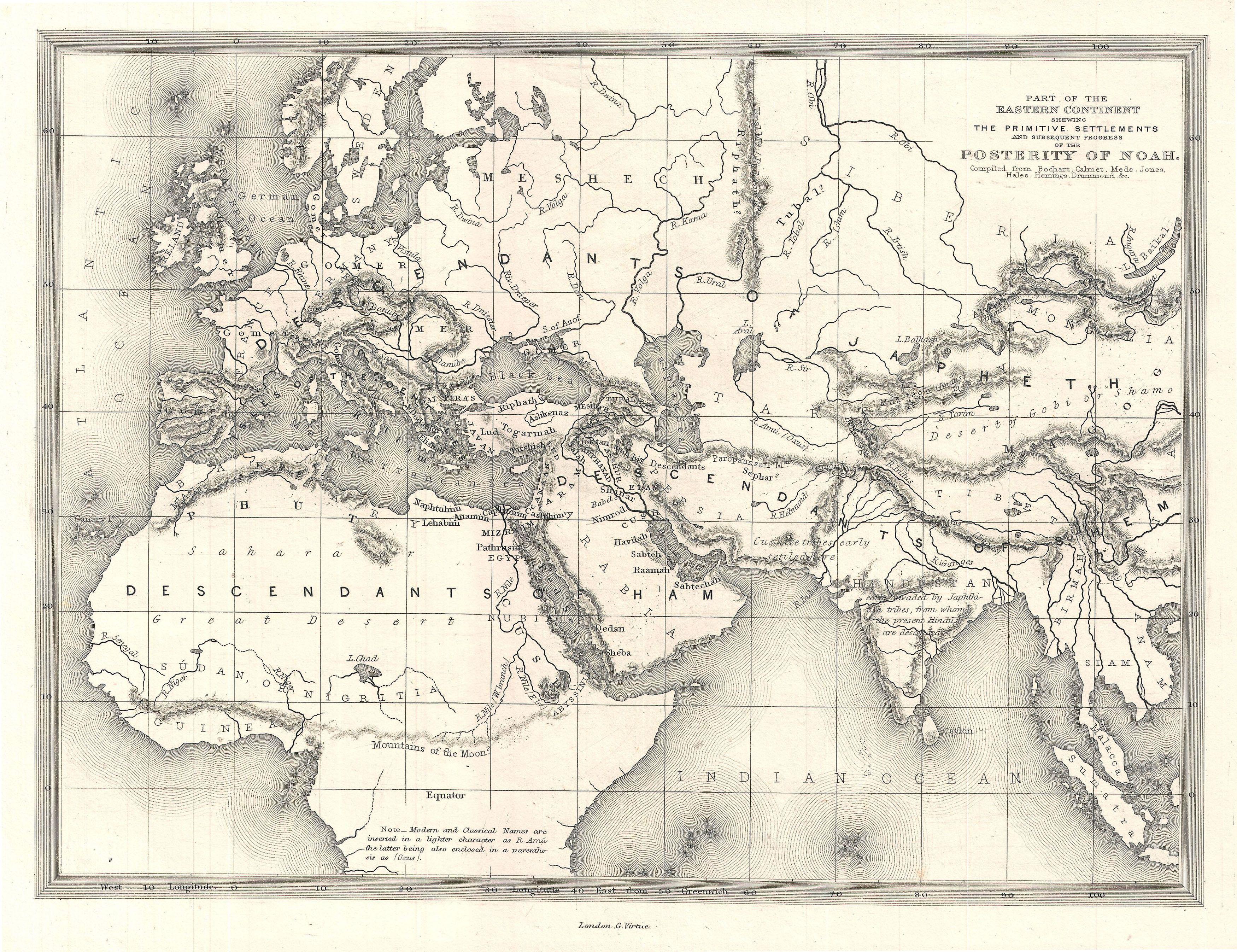
English: This is a beautiful c. 1850 map of Europe, northern Africa, and western Asia. Drawn to illustrated the Primitive Settlements and Subsequent Progress of the Posterity of Noah compiled from Bochart, Calmet, Mede, Jones, Hales, Hemings, and Drummond. Labels the lands where Ham, Japeth, and Shem (the sons of Noah) settled following the Deluge. Makes note of mountain ranges, rivers, and bodies of water. Note on bottom addresses the labeling of land using classical and modern names. |
|||||
| Date | circa 1850(undated) | |||||
| Dimensions | height: 10 in (25.4 cm); width: 14 in (35.5 cm) | |||||
| Accession number |
Geographicus link: PosterityOfNoah-bochart-1850 |
|||||
| Source/Photographer |
|
|||||
| Permission (Reusing this file) |
|
|||||
File history
Click on a date/time to view the file as it appeared at that time.
| Date/Time | Thumbnail | Dimensions | User | Comment | |
|---|---|---|---|---|---|
| current | 00:15, 25 March 2011 | | 3,500 × 2,693 (2.35 MB) | BotMultichillT (talk | contribs) | {{subst:User:Multichill/Geographicus |link=http://www.geographicus.com/P/AntiqueMap/PosterityOfNoah-bochart-1850 |product_name=1850s Map of the World of the Biblical Noah |map_title=Part of Eastern Continent Shewing The Primitive Settlements and Subsequen |
You cannot overwrite this file.
File usage on Commons
The following page uses this file: