File:1848 U.S. Coast Survey Map of New Jersey and Long Island - Geographicus - NewJerseyLongIsland-uscs-1848.jpg
Jump to navigation
Jump to search
Size of this preview: 715 × 599 pixels. Other resolutions: 286 × 240 pixels | 573 × 480 pixels | 916 × 768 pixels | 1,222 × 1,024 pixels | 2,444 × 2,048 pixels | 4,176 × 3,500 pixels.
Original file (4,176 × 3,500 pixels, file size: 1.86 MB, MIME type: image/jpeg)
Captions
Captions
Add a one-line explanation of what this file represents
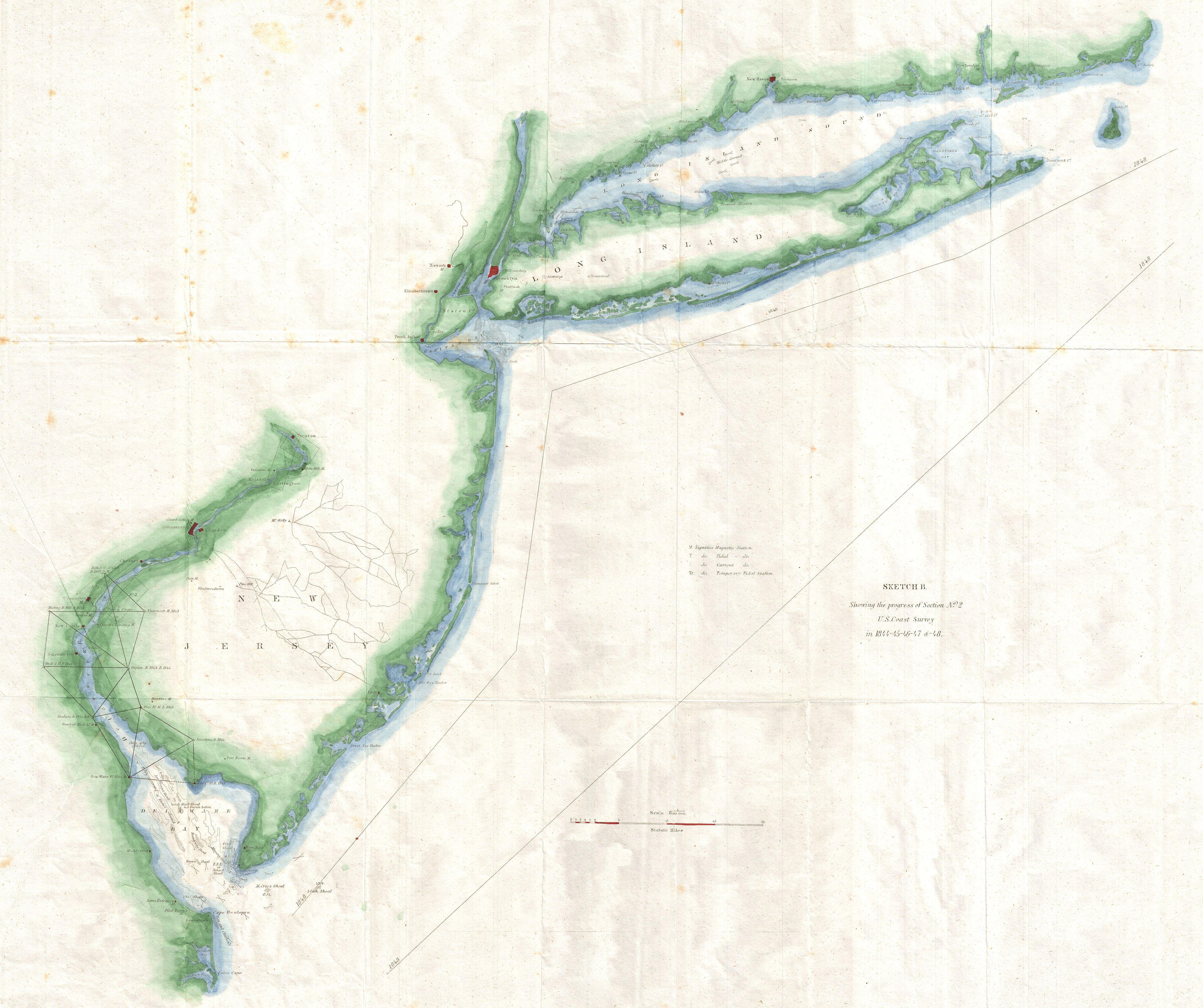
| Sketch B Showing the progress of Section No. 2 U.S. Coast survey in 1844 - 45 - 46 -47 & - 48. | |||||||
|---|---|---|---|---|---|---|---|
| Artist | |||||||
| Title |
Sketch B Showing the progress of Section No. 2 U.S. Coast survey in 1844 - 45 - 46 -47 & - 48. |
||||||
| Description |
English: A unusual triangulation chart of the New York and New Jersey coast line from the scarce 1848 edition of the Superintendent's Report . Covers from the Delaware Bay north to New York City then east along Long Island as far as Block Island. Shows various triangulation points and some of the attached river systems. Includes New York City, Philadelphia, Wilmington, Trenton, Newark, Elizabethtown, and New Haven. The 1848 edition of the Superintendent's Report is highly unusual in that its maps do not have borders, was common in all subsequent editions. |
||||||
| Date | 1848 (dated) | ||||||
| Dimensions | height: 22 in (55.8 cm); width: 26 in (66 cm) | ||||||
| Accession number |
Geographicus link: NewJerseyLongIsland-uscs-1848 |
||||||
| Source/Photographer |
Report of the Superintendant of the United States Coast Survey, Washington, (1848 edition).
|
||||||
| Permission (Reusing this file) |
|
||||||
.svg/64px-Great_Seal_of_the_United_States_(obverse).svg.png)
File history
Click on a date/time to view the file as it appeared at that time.
| Date/Time | Thumbnail | Dimensions | User | Comment | |
|---|---|---|---|---|---|
| current | 18:21, 24 March 2011 | | 4,176 × 3,500 (1.86 MB) | BotMultichillT (talk | contribs) | {{subst:User:Multichill/Geographicus |link=http://www.geographicus.com/P/AntiqueMap/NewJerseyLongIsland-uscs-1848 |product_name=1848 U.S. Coast Survey Map of New Jersey and Long Island |map_title=Sketch B Showing the progress of Section No. 2 U.S. Coast s |
You cannot overwrite this file.
File usage on Commons
The following page uses this file: