File:1747 La Feuille Map of Amsterdam and Vicinity, the Netherlands - Geographicus - Amstellande-ratelband-1747.jpg
Jump to navigation
Jump to search
Size of this preview: 800 × 533 pixels. Other resolutions: 320 × 213 pixels | 640 × 426 pixels | 1,024 × 682 pixels | 1,280 × 852 pixels | 2,500 × 1,665 pixels.
Original file (2,500 × 1,665 pixels, file size: 1.65 MB, MIME type: image/jpeg)
Captions
Captions
Add a one-line explanation of what this file represents
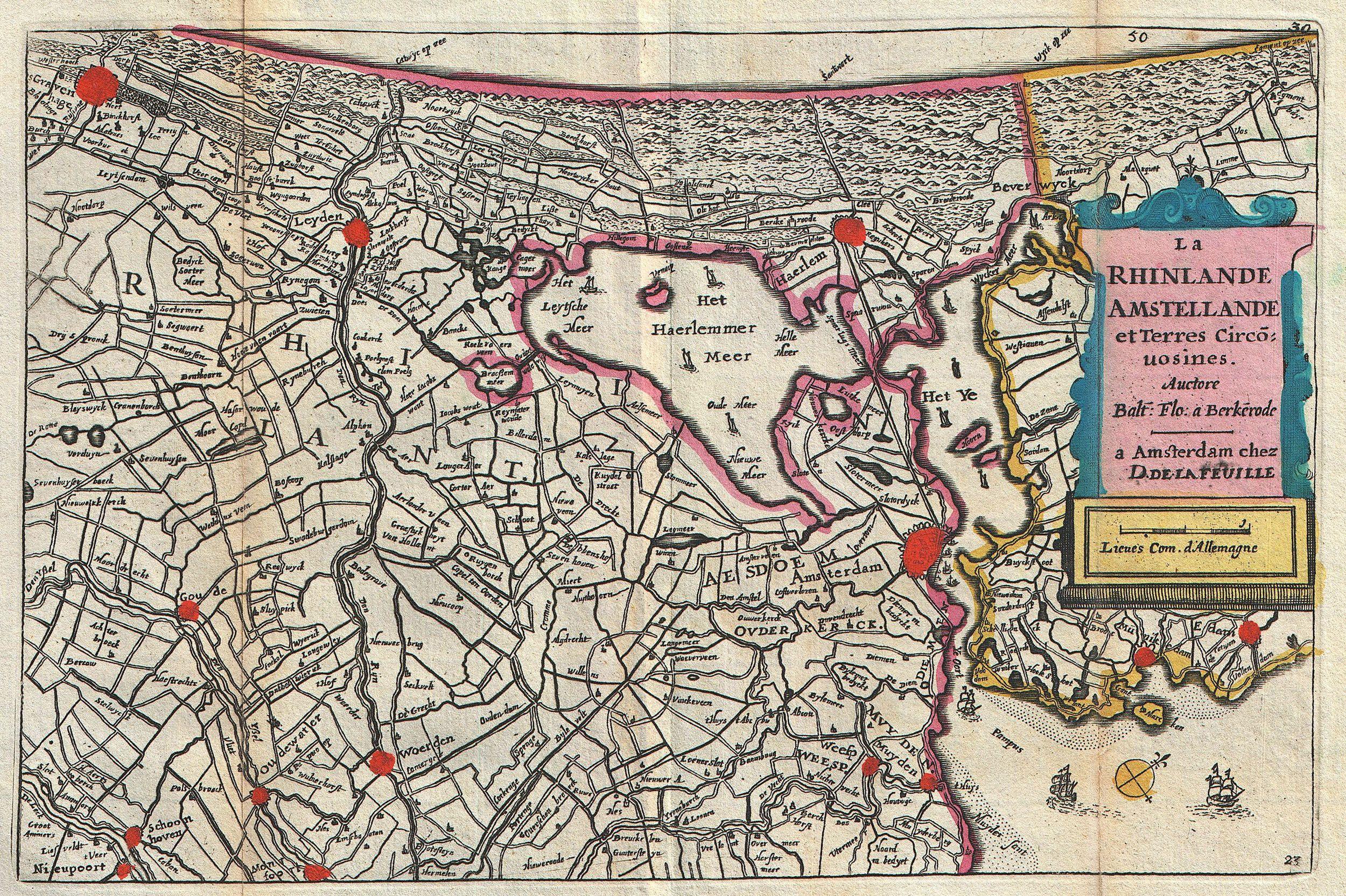
| La Rhinlande Amstellande et Terres Circo uosines.
( |
||||||||||||||||||||
|---|---|---|---|---|---|---|---|---|---|---|---|---|---|---|---|---|---|---|---|---|
| Artist |
|
|||||||||||||||||||
| Title |
La Rhinlande Amstellande et Terres Circo uosines. |
|||||||||||||||||||
| Description |
English: A stunning map of southern Holland (The Netherlands) and the vicinity of Amsterdam first drawn by Daniel de la Feuille in 1706. Based upon an earlier map by Balthazaro Florentio a Berkenrode who is credited in the title cartouche. Oriented to the southwest. Shows numerous sailing ships playing the Haarlemmermeer and the Zuiderzee. Covers from Amsterdam southward as far as Graven and Nieupoort. This is Paul de la Feuille’s 1747 reissue of his father Daniel’s 1706 map. Prepared for issue as plate no. 36 in J. Ratelband’s 1747 Geographisch-Toneel . |
|||||||||||||||||||
| Date | 1747 (undated) | |||||||||||||||||||
| Dimensions | height: 7 in (17.7 cm); width: 10.2 in (26 cm) | |||||||||||||||||||
| Accession number |
Geographicus link: Amstellande-ratelband-1747 |
|||||||||||||||||||
| Source/Photographer |
Geographisch-Toneel Of uitgezochte Kaarten, Tot gemak der Officieren, Reisigers en Liefhebbers; Behelsende alle de generale Kaarten ..., (1747 J. Ratelband issue.)
|
|||||||||||||||||||
| Permission (Reusing this file) |
|
|||||||||||||||||||
File history
Click on a date/time to view the file as it appeared at that time.
| Date/Time | Thumbnail | Dimensions | User | Comment | |
|---|---|---|---|---|---|
| current | 08:17, 19 March 2011 | | 2,500 × 1,665 (1.65 MB) | BotMultichill (talk | contribs) | {{subst:User:Multichill/Geographicus |link=http://www.geographicus.com/P/AntiqueMap/Amstellande-ratelband-1747 |product_name=1747 La Feuille Map of Amsterdam and Vicinity, the Netherlands |map_title=La Rhinlande Amstellande et Terres Circo uosines. |descr |
You cannot overwrite this file.
File usage on Commons
The following page uses this file: