File:1745 Anson Map or Chart of Zihuatanejo Harbor, Mexico - Geographicus - Seguataneo-anson-1745.jpg
Jump to navigation
Jump to search

Size of this preview: 800 × 444 pixels. Other resolutions: 320 × 178 pixels | 640 × 355 pixels | 1,024 × 569 pixels | 1,280 × 711 pixels | 2,560 × 1,421 pixels | 5,000 × 2,776 pixels.
Original file (5,000 × 2,776 pixels, file size: 4.23 MB, MIME type: image/jpeg)
Captions
Captions
Add a one-line explanation of what this file represents
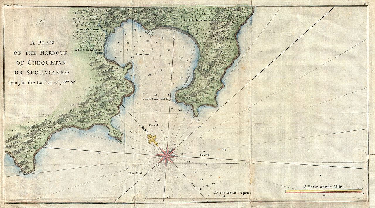
| A Plan of the Harbour of Chequetan or Seguataneo Lying in the Lat.d of 17 d. 36 m. No. | ||||||
|---|---|---|---|---|---|---|
| Artist | ||||||
| Title |
A Plan of the Harbour of Chequetan or Seguataneo Lying in the Lat.d of 17 d. 36 m. No. |
|||||
| Description |
English: An extremely attractive 1745 map of the Mexican harbor of Zihuatanejo Bay by George Anson.
|
|||||
| Date | 1745 (undated) | |||||
| Dimensions | height: 11 in (27.9 cm); width: 19.5 in (49.5 cm) | |||||
| Accession number |
Geographicus link: Seguataneo-anson-1745 |
|||||
| Source/Photographer |
Anson, G., Atlas to Anson's Voyage round the world. (1745)
|
|||||
| Permission (Reusing this file) |
|
|||||
File history
Click on a date/time to view the file as it appeared at that time.
| Date/Time | Thumbnail | Dimensions | User | Comment | |
|---|---|---|---|---|---|
| current | 08:59, 19 March 2011 | | 5,000 × 2,776 (4.23 MB) | BotMultichill (talk | contribs) | {{subst:User:Multichill/Geographicus |link=http://www.geographicus.com/P/AntiqueMap/Seguataneo-anson-1745 |product_name=1745 Anson Map or Chart of Zihuatanejo Harbor, Mexico |map_title=A Plan of the Harbour of Chequetan or Seguataneo Lying in the Lat.d of |
You cannot overwrite this file.
File usage on Commons
The following page uses this file:
File usage on other wikis
The following other wikis use this file:
- Usage on es.wikipedia.org