Category:Old maps of Brandenburg
Jump to navigation
Jump to search
Federal states of Germany:
Use the appropriate category for maps showing all or a large part of Brandenburg. See subcategories for smaller areas:
| If the map shows | Category to use |
|---|---|
| Brandenburg on a recently created map | Category:Maps of Brandenburg or its subcategories |
| Brandenburg on a map created more than 70 years ago | Category:Old maps of Brandenburg or its subcategories |
| the history of Brandenburg on a recently created map | Category:Maps of the history of Brandenburg or its subcategories |
| the history of Brandenburg on a map created more than 70 years ago | Category:Old maps of the history of Brandenburg or its subcategories |
Subcategories
This category has the following 12 subcategories, out of 12 total.
1
F
- Old maps of Fürstenberg/Havel (11 F)
L
- Old maps of Löwenberger Land (22 F)
O
P
- Parts of old maps of Brandenburg (86 F)
Media in category "Old maps of Brandenburg"
The following 61 files are in this category, out of 61 total.
-
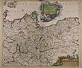
Brandenburg Pommern Mercator.jpg 3,273 × 2,531; 13.36 MB
-
Map of Brandenburg by Abraham Ortelius.jpeg 3,066 × 2,360; 2.31 MB
-
Central europe 1648 sheperd.jpg 2,314 × 1,880; 925 KB
-
Map of Brandenburg 1662.jpg 7,616 × 6,654; 25.53 MB
-
Giacomo Cantelli da Vignola - Marchesato et Elettorato di Brandebvrg (1687).jpg 4,457 × 3,438; 7.83 MB
-
Marchionatus Brandenburgensis - CBT 5875082.jpg 5,692 × 4,749; 6.17 MB
-
Land-Charte des Churfürstenthums Brandenburg 1724.jpg 13,568 × 8,400; 37.39 MB
-
Karte der Provinz Brandenburg (Brockhaus 1894).jpg 3,431 × 2,659; 4.06 MB
-
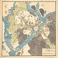
Topographische Carte Hundert Quadrat-Meilen um Berlin (5384787851) (cropped).jpg 1,129 × 834; 1.3 MB
-
Provinz Brandenburg 1905.png 1,800 × 1,368; 1.43 MB
-
Wagner Debes Weitere Umgebung von Berlin 1915.jpg 2,398 × 1,412; 2.33 MB
-
Berlin und Umgebung 1905.png 508 × 274; 94 KB
-
Map Potsdam-1773.jpg 5,042 × 5,147; 8.66 MB
-
Buhnenwerer karte.jpg 283 × 187; 3 KB
-
Elsterwerda 1834.jpg 7,472 × 6,572; 14.1 MB
-
Charte vom Königlich Preussischen Regierungsbezirk Frankfurt.jpg 1,724 × 2,141; 930 KB
-
1636 Frankfurt (Oder).png 370 × 283; 49 KB
-
Caspar Merian - Francofurtum ad Viadrum.jpg 1,410 × 1,098; 532 KB
-
Entstehung des Lebuser Geländes Lebus Tafel II.jpg 5,070 × 6,764; 25.21 MB
-
Havelland.jpg 1,450 × 1,138; 603 KB
-
Briesen Belzig Schenck1758.jpg 1,068 × 613; 905 KB
-
Kremmen.png 4,036 × 3,050; 14.1 MB
-
Landesberg - 33-53.jpg 3,082 × 5,019; 2.86 MB
-
LandschaftsgartenGarzau.jpg 250 × 370; 13 KB
-
Lausitz map 18thC.jpg 1,624 × 1,383; 3.01 MB
-
Charte vom Königlich Preussischen Regierungsbezirk Liegnitz.jpg 1,423 × 1,600; 948 KB
-
Plan-von-der-Gegent-bey-Potsdam.png 497 × 513; 211 KB
-
Meyer‘s Zeitungsatlas 034 – Provinz Brandenburg.jpg 7,344 × 6,273; 18.42 MB
-
Neumark Uckermark Joannes Blaeu.jpg 3,240 × 2,463; 10.98 MB
-
Neumark1337.jpg 1,768 × 1,471; 3.58 MB
-
Potsdam Stadtplan 1900.jpg 1,174 × 749; 240 KB
-
Potsdam in 1910.jpg 2,300 × 1,212; 1.04 MB
-
Preussen-GrKF.jpg 1,266 × 601; 309 KB
-
Reilly 339.jpg 1,644 × 1,242; 498 KB
-
Reilly 340.jpg 1,230 × 912; 610 KB
-
Reilly 340b.jpg 929 × 683; 312 KB
-
Reilly 341.jpg 1,102 × 847; 527 KB
-
Reilly 342.jpg 997 × 842; 370 KB
-
Reilly 343.jpg 900 × 739; 278 KB
-
Reilly 343b.jpg 583 × 463; 126 KB
-
Reilly 345.jpg 1,151 × 902; 446 KB
-
Reilly 348.jpg 1,106 × 872; 416 KB
-
Reilly 348b.jpg 651 × 517; 331 KB
-
Reilly 349.jpg 1,111 × 852; 494 KB
-
Reilly 357.jpg 1,211 × 1,016; 562 KB
-
Reilly 358.jpg 1,727 × 1,180; 508 KB
-
Reilly 358b.jpg 1,255 × 852; 497 KB
-
Rüthnicker Heide.png 4,024 × 3,064; 21.32 MB
-
Schradenkarte.jpg 3,688 × 2,770; 11.79 MB
-
Stettin - 32-53.jpg 3,096 × 4,961; 2.85 MB
-
1788 Kreis-Teltow.jpg 1,172 × 1,316; 646 KB
.jpg/120px-%22Marchionatus_brandenburgici_partes_duae_Nova_Marchiae_et_Uckerana_-_Auctore_Olao_Ioannis_Gotho...%22_(21637082413).jpg)
.jpg/120px-%22Marchionatus_Brandenburgici_partes_duae%2C_Ruppin_comitatus_%26_Prignits_regioncula_-_auct._Olao_Iohannis_Gotho...%22_(22070381028).jpg)
%27_(11054044055).jpg/120px-138_of_%27Abrisz_der_brandenburgisch-preuszischen_Geschichte._(With_maps.)%27_(11054044055).jpg)


.jpg/120px-Giacomo_Cantelli_da_Vignola_-_Marchesato_et_Elettorato_di_Brandebvrg_(1687).jpg)


_-_Geographicus_-_UpperSaxony-cary-1799.jpg/120px-1801_Cary_Map_of_Upper_Saxony%2C_Germany_(_Berlin%2C_Dresden_)_-_Geographicus_-_UpperSaxony-cary-1799.jpg)
.jpg/120px-Karte_der_Provinz_Brandenburg_(Brockhaus_1894).jpg)
_(cropped).jpg/120px-Topographische_Carte_Hundert_Quadrat-Meilen_um_Berlin_(5384787851)_(cropped).jpg)
_(Entenschnabel).jpg/120px-Topographische_Carte_Hundert_Quadrat-Meilen_um_Berlin_(5384787851)_(Entenschnabel).jpg)


.png/120px-1636_Frankfurt_(Oder).png)


_Ausschnitt_GHHK.png/120px-Giacomo_Cantelli_da_Vignola-Marchesato_et_Elettorato_di_Brandebvrg_(1687)_Ausschnitt_GHHK.png)

.jpg/120px-thumbnail.jpg)
.jpg/120px-thumbnail.jpg)
.jpg/120px-thumbnail.jpg)


