Category:Maps by the United States Army Map Service
Jump to navigation
Jump to search
Subcategories
This category has the following 45 subcategories, out of 45 total.
Media in category "Maps by the United States Army Map Service"
The following 22 files are in this category, out of 22 total.
-
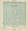
5303 Vanuatu Melanesia Eromanga Island 500K SE59-4.jpg 6,299 × 6,976; 25.33 MB
-
Ca. 1905 - 7 Sheet Military Map of Part of Southern Manchuria.jpg 4,117 × 3,800; 3.56 MB
-
India. Special strategic map - btv1b53189310m (1 of 2).jpg 11,892 × 7,424; 14.4 MB
-
India. Special strategic map - btv1b53189310m (2 of 2).jpg 10,116 × 7,120; 8.01 MB
-
Northern Europe, Series M515, U.S. Army Map Service, index.jpg 2,717 × 1,908; 1.45 MB
-
Pcc00002.jpg 1,162 × 828; 922 KB
-
Plano-de-la-Ciudad-de-Ceuta-1943.jpg 7,948 × 4,771; 7.13 MB
-
Santiago 1969 1-12,500, U.S. Army Topographic Command, Series J901, Sheet 2.jpg 9,500 × 6,447; 11.74 MB
-
Santiago 1969 1-12,500, U.S. Army Topographic Command, Series J901, Sheet 3.jpg 9,500 × 6,757; 13.54 MB
-
Sorae Salt Field 1946.png 2,000 × 2,000; 9.16 MB
-
Sorong-txu-oclc-6558822-sa52-3.jpg 4,113 × 4,741; 5.57 MB
-
The Near East - WDL - LOC.png 1,254 × 1,024; 1.85 MB
-
Txu-pclmaps-oclc-6583553-island-of-madeira.jpg 7,936 × 5,770; 13.04 MB
-
UdSSR-Karte NO 34-9 Rigaer Bucht - Haapsalu.jpg 5,727 × 4,349; 5.79 MB
-
UdSSR-Karte NO 34-9 Rigaer Bucht Ausschnitt.jpg 1,748 × 2,114; 899 KB
-
USSR map NL 37-7 Kerch'.jpg 5,743 × 4,366; 8.41 MB
-
Western Europe US Army map index.jpg 4,396 × 2,880; 2.22 MB

._G8000_1961_.U5._LCCN_map64000315..jpg/91px-Army_Map_Service%2C_Continental_Southeast_Asia%2C_Series_L206%2C_Edition_3-AMS_(FE)._G8000_1961_.U5._LCCN_map64000315..jpg)

.jpg/120px-India._Special_strategic_map_-_btv1b53189310m_(1_of_2).jpg)
.jpg/120px-India._Special_strategic_map_-_btv1b53189310m_(2_of_2).jpg)
.jpg/120px-Kerch%2C_the_Strait_of_Kerch_and_the_Taman_Peninsula_detail_from_1954_United_States_Army_Map_Service%2C_USSR_map_NL_37-7_Kerch%27_(cropped).jpg)


.jpg/90px-Strait_of_Kerch_-_from_1954_United_States_Army_Map_Service%2C_USSR_map_NL_37-7_Kerch%27_(cropped).jpg)
.jpg/120px-Strait_of_Kerch_detail_from_1954_United_States_Army_Map_Service%2C_USSR_map_NL_37-7_Kerch%27_(cropped).jpg)
.jpg/120px-Taman_Peninsula_map_detail_from_1954_United_States_Army_Map_Service%2C_USSR_map_NL_37-7_Kerch%27_(cropped).jpg)


