Category:Map Lab-en
Jump to navigation
Jump to search
- English: Maps which are improved by the English graphic atelier.
- Deutsch: Karten, die von der englischen Bildwerkstatt verbessert wurden.
- Français : Ces cartes ont été améliorées par les Wikigraphistes anglaise de l'Graphic Lab.
Template used to mark the improved images: {{Map Lab-en}}
As of 2024/02/01, there are 51 files in Category:Map Lab-en.
For the common images improved by the Graphic Lab, see : Category:Graphic Lab-en
This map was made or improved by the Wikigraphists of the Graphic Lab. You can propose maps or images to clean up and improve as well.
Cette carte a été créée ou améliorée par les Wikigraphistes de l'Graphic Lab. Vous pouvez également y proposer des cartes ou des images à améliorer.
Subcategories
This category has only the following subcategory.
S
Media in category "Map Lab-en"
The following 51 files are in this category, out of 51 total.
-
2019 US vaping lung disease outbreak - cases.svg 962 × 583; 69 KB
-
2019 US vaping lung disease outbreak - fatalities.svg 962 × 583; 67 KB
-
Amish in Ohio locator map.svg 512 × 545; 516 KB
-
Arctic (orthographic projection with highlights).svg 512 × 512; 412 KB
-
Assyria World War 1 relief English.png 3,507 × 2,480; 751 KB
-
Bancroft uranium mining map.svg 739 × 545; 3.35 MB
-
Basin and Range Province Boundaries and Landmarks.svg 383 × 464; 324 KB
-
Bikini Atoll Operation Crossroads.svg 852 × 702; 68 KB
-
Canada Vancouver Island location map.svg 724 × 685; 507 KB
-
Canada Vancouver Island relief map.jpg 3,017 × 2,851; 1.74 MB
-
Climate emergency declaration map.svg 2,754 × 1,398; 1.06 MB
-
Crown of Castile.png 2,000 × 1,602; 394 KB
-
Diocese of Morombe in Madagascar map.svg 765 × 1,260; 991 KB
-
District of Columbia mayoral election results by ward, 2022.svg 512 × 636; 15 KB
-
Dutch Brazil 1630-1654 map.svg 935 × 837; 1.75 MB
-
El Salt topo map.svg 661 × 467; 2.28 MB
-
Flag map of Rhodesia (1964–1968).svg 766 × 699; 104 KB
-
Flag map of Southern Rhodesia (1924–1964).svg 766 × 699; 94 KB
-
Flag map of Zimbabwe Rhodesia (1979).svg 769 × 699; 29 KB
-
German destroyer Z39 map.svg 1,839 × 1,573; 4.62 MB
-
Hilfe Geotools Beispiel 2.svg 454 × 230; 105 KB
-
Iberia 300BC-en.svg 924 × 762; 772 KB
-
Indian states that ban forced conversions map.svg 2,000 × 2,153; 1.05 MB
-
Kalakaua's 1874-75 state visit map.svg 1,701 × 872; 154 KB
-
Kurdish-inhabited areas (orthographic projection with inset).svg 512 × 512; 852 KB
-
London Underground Northern line extension map.svg 1,175 × 807; 207 KB
-
London Underground proposed Bakerloo line extension map.svg 993 × 593; 145 KB
-
Madagascar districts location map.svg 765 × 1,260; 992 KB
-
Map of countries that ban Muslim Brotherhood.svg 2,754 × 1,398; 1.05 MB
-
Map of US states that ban fracking.svg 959 × 593; 57 KB
-
Mexico 1865 Aguascalientes locator map.svg 512 × 344; 192 KB
-
Northwest Territory locator map (1787).svg 512 × 505; 248 KB
-
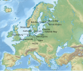
Orient-Express Historic Routes (en).svg 738 × 570; 381 KB
-
Orient-Express Historic Routes (hy).png 758 × 570; 180 KB
-
Orient-Express Historic Routes.svg 738 × 570; 381 KB
-
Orient-Express Routes Historiques (fr).svg 758 × 570; 141 KB
-
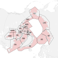
Polar bear subpopulation map.svg 655 × 648; 717 KB
-
SAARC3.svg 940 × 477; 1.17 MB
-
Sciurocheirus makandensis distribution.svg 843 × 596; 167 KB
-
Serbian Empire 1355 CE relief english (draft 3).svg 595 × 842; 4.5 MB
-
Serbian Empire 1355 CE relief English.png 2,586 × 3,507; 2.63 MB
-
Sri Lanka Railroads Map.svg 582 × 750; 399 KB
-
Tasmania electoral divisions 2016.svg 512 × 563; 95 KB
-
U.S. states, by sanctuary cities policy.svg 950 × 621; 64 KB
-
Upper Silesian Industrial Region location map.svg 1,052 × 638; 132 KB
-
Welsh speakers in the 2021 census.svg 512 × 561; 427 KB
-
WikiProject Asian Americans map.svg 574 × 341; 1.07 MB
-
Yug1.svg 512 × 286; 665 KB
-
Yug2.svg 512 × 342; 401 KB
-
Zambesia location map.svg 524 × 333; 787 KB


.svg/120px-Arctic_(orthographic_projection_with_highlights).svg.png)


.svg/120px-Flag_map_of_Rhodesia_(1964–1968).svg.png)
.svg/120px-Flag_map_of_Southern_Rhodesia_(1924–1964).svg.png)
.svg/120px-Flag_map_of_Zimbabwe_Rhodesia_(1979).svg.png)


.svg/120px-Kurdish-inhabited_areas_(orthographic_projection_with_inset).svg.png)


.svg/120px-Northwest_Territory_locator_map_(1787).svg.png)
.svg/120px-Orient-Express_Historic_Routes_(en).svg.png)
.png/120px-Orient-Express_Historic_Routes_(hy).png)

.svg/120px-Orient-Express_Routes_Historiques_(fr).svg.png)


.svg/85px-Serbian_Empire_1355_CE_relief_english_(draft_3).svg.png)


