Category:English-language SVG maps
Jump to navigation
Jump to search
Subcategories
This category has the following 7 subcategories, out of 7 total.
E
Media in category "English-language SVG maps"
The following 200 files are in this category, out of 535 total.
(previous page) (next page)-
2000cardistribution.svg 940 × 415; 1.61 MB
-
2006megacities.svg 1,425 × 625; 1.42 MB
-
2012copper (mined).svg 2,754 × 1,397; 1.69 MB
-
2013 Inflation rates map of the world per International Monetary Fund.svg 863 × 443; 1.55 MB
-
2023 Israel–Hamas war - Bab-el-Mandeb.svg 7,148 × 8,737; 9.76 MB
-
AMPS World Sectors.svg 512 × 253; 587 KB
-
Ancient Near East 0800BC.svg 2,102 × 1,510; 4.81 MB
-
Annual Trend in Euromoney Country Risk, March 2000 - March 2011.svg 1,080 × 540; 385 KB
-
Annual-deforestation.svg 850 × 600; 168 KB
-
Antarctic-seas-en.svg 1,110 × 800; 46 KB
-
Antarctica (version 2).svg 512 × 511; 1.17 MB
-
Antarctica.svg 512 × 511; 655 KB
-
AOCWorldMap.svg 940 × 477; 950 KB
-
Apollo 11 photo map.svg 709 × 709; 740 KB
-
Archaic globalization.svg 1,417 × 1,063; 430 KB
-
Arctic big.svg 1,010 × 1,267; 1 MB
-
Arshakuni Armenia 150-en.svg 2,717 × 1,595; 850 KB
-
ATI World Map June 2018.svg 1,200 × 630; 3.58 MB
-
Atlantica-2Ga.svg 594 × 527; 32 KB
-
Aukh district.svg 400 × 528; 849 KB
-
Australian renewable power plants map-en.svg 1,146 × 808; 1.35 MB
-
Badr campaign.svg 200 × 290; 43 KB
-
Banks Islands-en.svg 1,002 × 1,508; 323 KB
-
Basketball at the 2012 Olympic Games - men, en.svg 863 × 443; 1.58 MB
-
Basque Geographical Traces.svg 731 × 585; 225 KB
-
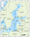
Bathymetric map of the Baltic Sea-en.svg 684 × 824; 2.82 MB
-
Battle for Misrata.svg 2,700 × 1,600; 85 KB
-
Battle of Donetsk Airport.svg 767 × 473; 180 KB
-
Battle of Quiberon Bay - 1759 - Tracks map-en.svg 670 × 912; 125 KB
-
Battle of the Gebora-en.svg 1,432 × 1,167; 86 KB
-
Beijing 2008 olympic venue.svg 3,934 × 2,913; 1.17 MB
-
BelarusElections2020-InternationalReaction.svg 1,104 × 566; 1.44 MB
-
Belize, administrative divisions - en - monochrome.svg 788 × 1,092; 177 KB
-
Benue Trough faults.svg 411 × 308; 14 KB
-
Berlengas archipelago geology-en.svg 1,183 × 1,593; 77 KB
-
Berlengas-en.svg 1,500 × 1,219; 193 KB
-
Bermuda topographic map-en.svg 2,580 × 1,820; 1.13 MB
-
Bermuda Triangle en-vector.svg 1,600 × 1,200; 87 KB
-
Beta Israel in Ethiopia - en.svg 1,843 × 1,494; 357 KB
-
Bodoland Territorial Area Districts.svg 1,005 × 660; 400 KB
-
Bosilovo Municipality en.svg 860 × 1,240; 419 KB
-
Braggville 1850-1880, Map of.svg 2,217 × 1,478; 688 KB
-
Breuschstellung-map-en.svg 1,047 × 1,167; 498 KB
-
Bristol Channel map.svg 585 × 414; 52 KB
-
British Overseas Territories.svg 1,652 × 1,221; 732 KB
-
Britned map.svg 571 × 342; 147 KB
-
BrnBld ArcticCurrents.svg 932 × 903; 62 KB
-
Busan-Subway-English.svg 720 × 650; 88 KB
-
Byzantine Constantinople-en.svg 2,085 × 1,889; 3.69 MB
-
Caraquet topographic map en.svg 1,275 × 999; 437 KB
-
Caribbean maritime boundaries map.svg 3,561 × 2,221; 2.78 MB
-
Carnac Island map.svg 536 × 731; 59 KB
-
Carte topographique Bathurst en.svg 1,150 × 800; 444 KB
-
Cayman Islands Electoral District Map labelled.svg 105 × 45; 27 KB
-
Cayman Islands Electoral District Map.svg 96 × 36; 43 KB
-
Cayman Islands electoral results, 2017.svg 384 × 144; 60 KB
-
Cayman Islands Map.svg 502 × 249; 15 KB
-
CBBT Info Sign.svg 2,702 × 1,696; 83 KB
-
Celtic Sea and Bay of Biscay bathymetric map-en.svg 3,479 × 3,805; 4.93 MB
-
Centre Spatial Guyanais orbital launchpads.svg 938 × 788; 36 KB
-
Cfbs-en.svg 1,009 × 503; 276 KB
-
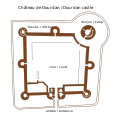
Chateau de Dourdan.svg 1,417 × 1,417; 16 KB
-
Chatham-Islands map topo en.svg 1,669 × 1,425; 814 KB
-
Chesapeake and Ohio Canal National Historical Park (map).svg 1,003 × 2,514; 5.42 MB
-
China-Historic macro areas.svg 1,438 × 1,047; 3.61 MB
-
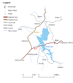
Chinese Eastern Railway-en.svg 909 × 793; 67 KB
-
Chios topographic map-en.svg 1,580 × 1,150; 1.4 MB
-
Chongqing1.svg 948 × 969; 1.76 MB
-
Choropleth-density.svg 1,000 × 750; 2.19 MB
-
Chuo Alps hiking map.svg 744 × 1,052; 1.62 MB
-
Church of the East provinces 10 c.svg 661 × 469; 590 KB
-
Chuuk islands.svg 1,140 × 888; 860 KB
-
CIA World Factbook 2016 physical world map.svg 512 × 259; 13.61 MB
-
CIA World Factbook 2021 physical world map.svg 2,774 × 1,424; 14.67 MB
-
CIA World Factbook 2021 political world map.svg 3,472 × 1,779; 50.08 MB
-
Circum-Baikal Railway.svg 800 × 649; 772 KB
-
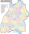
Cities and Districts in Baden-Wuerttemberg.svg 753 × 868; 183 KB
-
Climate-tipping-points-en.svg 2,479 × 1,409; 420 KB
-
CO2 responsibility 1950-2000.svg 940 × 477; 1.98 MB
-
Coalition action against Libya-en.svg 972 × 1,022; 1.34 MB
-
Colorado map of Köppen climate classification.svg 1,900 × 1,900; 169 KB
-
Conceptions Colomb map-en.svg 1,022 × 635; 857 KB
-
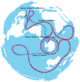
Conveyor belt.svg 313 × 322; 101 KB
-
Corfu Channel topographic map-en.svg 595 × 755; 2.23 MB
-
Corfu topographic map-en.svg 2,096 × 2,341; 2.19 MB
-
Corrientes-oceanicas-en.svg 976 × 493; 1.63 MB
-
Countries by Birth Rate in 2014.svg 863 × 396; 1.14 MB
-
Countries by Birth Rate in 2017.svg 863 × 396; 1.29 MB
-
Course Channeltunnel en.svg 472 × 387; 43 KB
-
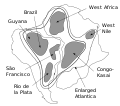
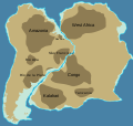
Cratons West Gondwana.svg 745 × 710; 170 KB
-
CretaceousIndiaBriggs.svg 292 × 314; 17 KB
-
Crete integrated map-en.svg 900 × 425; 265 KB
-
CTA L map.svg 746 × 1,297; 658 KB
-
Curonian Spit and Lagoon.svg 744 × 1,052; 69 KB
-
Currents.svg 330 × 311; 376 KB
-
Daakaka-region on Ambrym Vanuatu.svg 511 × 358; 131 KB
-
Dagestan.svg 391 × 528; 871 KB
-
Daimler manufacturing locations.svg 881 × 389; 1.45 MB
-
Dakar Rally 2010 map-en.svg 1,513 × 1,584; 3.53 MB
-
Dakar Rally 2011 map-en.svg 1,513 × 1,584; 3.42 MB
-
Dasht-i-Leili massacre pits.svg 289 × 261; 31 KB
-
Decolonization - World Today en.svg 1,438 × 832; 3.76 MB
-
Demak Sultanate conquests and expeditions.svg 1,327 × 544; 307 KB
-
Detail site Kourou-en.svg 750 × 1,030; 92 KB
-
Diachronic map of the Spanish Empire 2.svg 863 × 443; 6.05 MB
-
Diachronic map of the Spanish Empire.svg 4,371 × 2,284; 6.47 MB
-
Djerba topographic map-en.svg 1,100 × 990; 564 KB
-
Dobrudja topographic map-en.svg 2,800 × 2,268; 2.33 MB
-
Dominica, administrative divisions - en - monochrome.svg 2,500 × 3,700; 119 KB
-
East Side Access.svg 546 × 396; 18 KB
-
Easter Island map-en.svg 1,750 × 1,245; 878 KB
-
Ecuador map of Köppen climate classification.svg 1,900 × 1,465; 184 KB
-
EIA World Shale Gas Map-en.svg 636 × 318; 1.97 MB
-
Eldfell eruption en.svg 717 × 721; 82 KB
-
Electoral boundaries during the Singapore general elections 2020.svg 2,876 × 1,907; 286 KB
-
Ethnic composition of Pidliashshia, Rittikh, 1875-en.svg 780 × 1,340; 244 KB
-
Euramerica en.svg 831 × 594; 257 KB
-
Falklands-Gondwana.svg 519 × 435; 29 KB
-
Fergana Valley map-en.svg 840 × 629; 1.22 MB
-
Flight MH370 last ping corridors alt.svg 709 × 500; 418 KB
-
Flight MH370 last ping corridors.svg 709 × 500; 206 KB
-
Fontevraud Abbey map-en.svg 2,650 × 2,258; 92 KB
-
French Hercynian massifs EN.svg 850 × 590; 274 KB
-
Froissy-Dompierre Railway map-en.svg 1,800 × 1,400; 1.2 MB
-
Future MTR Network.svg 5,300 × 3,500; 66 KB
-
Galapagos Island Names.svg 280 × 370; 68 KB
-
Galicia & Galicia Bank-en.svg 1,491 × 663; 4.46 MB
-
Gas hydrates 1996.svg 940 × 477; 1.58 MB
-
GDP in dollars worldmap-2015.svg 940 × 477; 1.86 MB
-
GDP per capita PPP 2014-en.svg 1,024 × 559; 486 KB
-
GDP per capita-worldmap-2006.svg 940 × 477; 2.27 MB
-
GDP-2014-symbol-en-01.svg 1,024 × 558; 462 KB
-
Geological units of the Iberian Peninsula EN.svg 542 × 603; 184 KB
-
Global Forest Area.svg 792 × 612; 447 KB
-
Goblyn Dungeon Map Template and Map Symbols.svg 1,826 × 814; 251 KB
-
Golfe de gascogne-bay of biscay-en.svg 680 × 686; 110 KB
-
Gori map.svg 744 × 1,052; 803 KB
-
Great Rift Valley map-en.svg 1,403 × 1,808; 1.05 MB
-
Great-Lakes.svg 786 × 533; 76 KB
-
Greatcircle Jetstream routes.svg 815 × 374; 54 KB
-
Greater Toronto Area map.svg 643 × 500; 327 KB
-
Miletus Bay silting evolution map-en.svg 1,857 × 1,349; 1.54 MB
-
Grunwald stage1.svg 727 × 507; 19 KB
-
GruzanskoEng.svg 542 × 614; 123 KB
-
Guanay cormorant distribution map.svg 4,500 × 2,234; 4.56 MB
-
Guatemala map en.svg 686 × 706; 69 KB
-
Gulf of Sirt Front 11 April.svg 3,800 × 1,940; 192 KB
-
Gulf of Sirt Front 2011-08-28T22-36-13.svg 3,800 × 1,940; 602 KB
-
Gulf of Sirt Front 23 August.svg 3,800 × 1,940; 197 KB
-
Gulf of Sirt Front 29 March.svg 3,800 × 1,940; 184 KB
-
Gulf of Sirt Front.svg 3,800 × 1,940; 198 KB
-
Hai River Basin EN.svg 715 × 883; 66 KB
-
Heimeya en.svg 433 × 403; 39 KB
-
Hercynian structures Europe-en.svg 850 × 555; 131 KB
-
Hercynides EN.svg 550 × 370; 108 KB
-
Herodotus world map-en.svg 788 × 476; 319 KB
-
Holocene-crop-domestication-en.svg 1,613 × 743; 252 KB
-
Holyoke Range map-en.svg 1,360 × 372; 142 KB
-
Human occupation areas in Alcalá de Henares - map-en.svg 1,680 × 1,120; 337 KB
-
Iapetus fossil evidence EN.svg 574 × 375; 109 KB
-
Illas Cíes Topographic Map en.svg 1,533 × 2,882; 778 KB
-
ImbrosTenedos 2.svg 725 × 674; 203 KB
-
Imperial Palace Tokyo Map.svg 383 × 500; 384 KB
-
In Amenas hostage crisis map.svg 512 × 193; 809 KB
-
Israel-Lebanon-Syria-border-Conflict-2023.svg 6,248 × 6,264; 9.53 MB
-
Jerusalem Armenian Quarter.svg 321 × 275; 20 KB
-
Jingnan Campaign (English).svg 806 × 1,144; 1.99 MB
-
Josephustable 3.svg 588 × 361; 237 KB
-
Kabul City Map.svg 2,580 × 1,898; 700 KB
-
Kaiten bases locations.svg 512 × 249; 88 KB
-
Kamatapuri-lects-regions.svg 194 × 143; 25 KB
-
Kamloops flight times.svg 1,304 × 1,263; 22 KB
-
Karta na muftistvata vo Makedonija en.svg 744 × 581; 427 KB
-
KarteInleSee.svg 750 × 1,052; 70 KB
-
Kasai River DRC.svg 671 × 559; 124 KB
-
Kastelorizo.svg 920 × 614; 647 KB
-
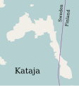
Kataja-en.svg 1,134 × 1,220; 31 KB
-
Kaziranga-National-Park-map-en-mod.svg 2,000 × 1,050; 155 KB
-
Kennesawmt.svg 744 × 1,052; 82 KB
-
Kenya map of Köppen climate classification.svg 1,900 × 1,900; 158 KB
-
Khadakwasla Dam Map.svg 700 × 447; 24 KB
-
King George Island map-en.svg 661 × 403; 209 KB
-
Kisimul Castle Map Labelled-en.svg 744 × 714; 248 KB
-
Kisimul Castle Map-en.svg 744 × 714; 248 KB
-
Klaus storm track - 20090124 - map-en.svg 2,000 × 1,922; 1.08 MB
-
Koiluoto-en.svg 646 × 338; 161 KB
-
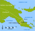
Kokoda trail location.svg 709 × 625; 30 KB
-
Kokoda trail.svg 241 × 735; 8.06 MB
-
Korea DMZ.svg 800 × 600; 59 KB
-
Kosovo map-en.svg 1,777 × 1,830; 3.81 MB
-
Kozhikode-district-map-en.svg 2,010 × 2,968; 4.14 MB
-
Ladakh2.svg 2,100 × 1,900; 581 KB
-
LaMia Flight 2933 route map.svg 1,167 × 938; 683 KB
-
Landkreise Niedersachsen-en.svg 1,121 × 978; 167 KB
-
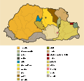
Languages of Bhutan with key-en.svg 875 × 850; 330 KB
-
Languages of Bhutan with labels.svg 875 × 476; 185 KB
-
Last Glacial Maximum Vegetation Map.svg 1,200 × 800; 316 KB


.svg/120px-2012copper_(mined).svg.png)


.svg/120px-Antarctica_(version_2).svg.png)




















.svg/84px-Jingnan_Campaign_(English).svg.png)


