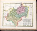
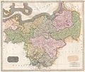
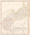
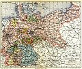
Category:19th-century maps of Prussia
Jump to navigation
Jump to search
Subcategories
This category has the following 5 subcategories, out of 5 total.
1
- 1830s maps of Prussia (7 F)
- 1860s maps of Prussia (11 F)
- 1890s maps of Prussia (13 F)
Media in category "19th-century maps of Prussia"
The following 50 files are in this category, out of 50 total.
-
Szyski Gilly.jpg 1,063 × 1,006; 497 KB
-
Tilsit-Ragnit-Baublen.jpg 3,168 × 4,713; 3.64 MB
-
Swierczynsko mapa Gilly.jpg 785 × 517; 617 KB
-
Charte vom Königreiche Preussen oder Ost- West- Süd Und Neu- Ost-Preussen.jpg 8,382 × 6,966; 17.88 MB
-
Robert Wilkinson - Prussia.pdf 13,875 × 11,808; 5.06 MB
-
A map of Prussia Wellcome V0049919.jpg 3,168 × 2,316; 2.93 MB
-
Russland BV023379535.jpg 9,009 × 6,172; 6.77 MB
-
1815 Thomson Map of Prussia, Germany - Geographicus - Prussia-t-15.jpg 5,000 × 4,212; 3.61 MB
-
Carte réduite de la Mer Baltique, IIe Feuille - btv1b105676011.jpg 12,161 × 8,332; 8.6 MB
-
Das Fürstenthum Breslau, oder der Breslausche Und Neumarcktsche Kreis.jpg 10,032 × 6,976; 24.03 MB
-
Подробная карта Российской империи и близлежащих заграничных владений — лист 005.jpg 4,887 × 4,478; 9.43 MB
-
Подробная карта Российской империи и близлежащих заграничных владений — лист 006.jpg 4,872 × 4,488; 13.1 MB
-
Подробная карта Российской империи и близлежащих заграничных владений — лист 015.jpg 4,892 × 4,487; 13.53 MB
-
1818 Pinkerton Map of Poland - Geographicus - Poland-pinkerton-1818.jpg 5,000 × 3,691; 5.15 MB
-
Toeppen Preussen 1818.jpg 4,868 × 3,938; 3.31 MB
-
Kongresspolen BV036670536.jpg 7,050 × 5,844; 6.43 MB
-
Der Preussische Staat.jpg 6,939 × 5,832; 10.94 MB
-
Carte de Prusse - dressée par Pierre Tardieu - btv1b530879924.jpg 10,080 × 7,408; 11.42 MB
-
Preußen 1842 Karte.jpg 3,750 × 3,000; 2.18 MB
-
1843 Malte-Brun Map of Prussia, Germany - Geographicus - Prussia-malteburn-1843.jpg 3,000 × 2,084; 1.82 MB
-
Die IV mittleren Provinzen des Preussischen Staats Platt 1848.pdf 2,872 × 2,320; 765 KB
-
Karte des preussischen Staats Platt 1848.pdf 2,872 × 2,320; 814 KB
-
Meyer‘s Zeitungsatlas 021 – Preussen.jpg 5,804 × 4,325; 11.9 MB
-
Preuss. Provinzen Preussen u. Posen, Kgr. Polen und Freistaat Krakau.jpg 1,689 × 1,982; 929 KB
-
Die Preuss. Provinzen Preussen und Posen.jpg 5,547 × 4,495; 8.22 MB
-
Periode der Verluste.jpg 1,613 × 2,472; 1.28 MB
-
Provinz Preussen und Kongresspolen 1871.jpg 2,924 × 3,392; 2.28 MB
-
1872 Mitchell Map of Prussia, Germany - Geographicus - Prussia-mitchell-1872.jpg 3,500 × 2,796; 3.51 MB
-
Westerwälder Braunkohlerevier.PNG 808 × 606; 1.13 MB
-
119 of 'Die Hohenzollern und das Reich, etc' (11171344114).jpg 2,544 × 1,701; 1.2 MB
-
Meyers b12 s0541a.jpg 2,048 × 1,647; 896 KB
-
Meyers b13 s0338a.jpg 3,096 × 1,777; 1.05 MB
-
Meyers b4 s0800a.jpg 2,048 × 1,720; 913 KB
-
Preussen-1806.jpg 1,000 × 502; 187 KB
-
BV042518398.tif 4,937 × 6,732; 47.51 MB
-
Preußen 1688 1806 1815 1866.jpg 1,479 × 1,175; 466 KB
-
A chart of Prussia and Coerland from Rygshead to der Winda - btv1b5973491q.jpg 7,408 × 5,928; 6.77 MB
-
Barclay's Dictionary Prussia and Poland.jpg 5,953 × 4,778; 19.14 MB
-
Meyers b13 s0363a.jpg 2,048 × 1,754; 773 KB


.jpg/120px-Charte_von_den_Königreichen_Preussen_und_Polen_dem_Grosherzogthum_Posen_nebst_dem_Gebiete_der_freien_Stadt_Krakau_(35048882391).jpg)


_With_numerous_maps_and_notes%27_(11110059245).jpg/120px-thumbnail.jpg)


%27_(11059105433).jpg/120px-58_of_%27(A_System_of_Geography%2C_for_the_use_of_Schools._Illustrated_with_more_than_fifty_cerographic_maps%2C_and_numerous_wood-cut_engravings.)%27_(11059105433).jpg)


.jpg/120px-119_of_%27Die_Hohenzollern_und_das_Reich%2C_etc%27_(11171344114).jpg)
%27_(11173032074).jpg/79px-624_of_%27(The_Gallery_of_Geography%2C_a_pictorial_and_descriptive_tour_of_the_world.)%27_(11173032074).jpg)
%27_(11172070595).jpg/79px-625_of_%27(The_Gallery_of_Geography%2C_a_pictorial_and_descriptive_tour_of_the_world.)%27_(11172070595).jpg)


_-_btv1b84394462_(1_of_2).jpg/120px-thumbnail.jpg)


.jpg/120px-267_of_%27Overzicht_der_algemeene_en_vaderl._geschiedenis%2C_met_20_historische_Kaarten%2C_voor_de_hoogere_Klassen%2C_etc%27_(11221018135).jpg)


.jpg/120px-Image_taken_from_page_253_of_%27Die_Hohenzollern_und_das_Reich%2C_etc%27_(16403266270).jpg)
